At this time last summer, several hurricanes in the Atlantic were in the process of churning through the Caribbean and the Gulf of Mexico. They brought massive flooding to American cities like Houston, Texas, and left island nations like Puerto Rico in ruins.
So far, this summer has been much calmer in the Atlantic—a visit to the National Hurricane Center website shows no storms on the horizon. But the same cannot be said about the world's largest ocean, the Pacific.
By Wednesday morning, meteorologists were surprised to see that a new storm had gone from a relatively minor tropical storm into a full-blown hurricane: Hurricane Lane. And it was on a potential collision course with Hawaii.
Floods arrive first
First off, the hurricane has not yet made landfall, or reached the shore. And it might not. For now, the state is still warning Hawaiians to be ready.
Be ready for threats of #HurricaneLane today into the weekend. Potential continues for dangerous impacts. #HIwx pic.twitter.com/cL8Ft96t7n
— NWSHonolulu (@NWSHonolulu) August 24, 2018
But in parts of Hawaii, flooding has already begun. Why?
Many storms surround the edges of hurricanes like this one. They don't have the same powerful winds, but they do bring massive amounts of rain. These slow-moving storms hit parts of Hawaii Thursday, especially the island of Hawaii, a.k.a. The Big Island. Many of these places have received 76 centimetres (30 inches) or more of rain in just 24 hours. This has led flash flooding.
Splash in a flash
A car is stuck in flood waters in the city of Hilo on Hawaii island. (Getty Embed)
Flash floods occur when sudden and massive amounts of rainfall overload the drainage system of an area. You can think of it like dumping a bunch of large buckets of water in a bathtub at once. Even if the plug is pulled, it will take that water a while to drain because there is so much of it.
This rainfall has left many neighbourhoods deep underwater. And because these flash floods have also triggered landslides in some areas, those 'drains' could be further clogged by mud and debris. This means that the water would continue to have nowhere to go. All this and the hurricane, which would add 180 km/h (115 mph) winds and storm surge waters to the mix, hasn't even arrived yet.
So will it or won't it?
Who feels the pain of Lane?
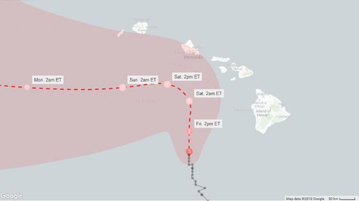
The predicted path of Hurricane Lane by Friday morning. (Google/NOAA/CNN)
Though a storm's path can be predicted, hurricanes can change direction—as well as gain and lose their strength—fairly quickly. For example, for a while on Wednesday, Lane registered as a Category 5 hurricane. That is as strong as they get, putting it in the same league as Irma and Maria last summer. Now it is just Category 3—mighty, but not as bad as it could be. In short, experts can only warn the public and guess. There are no guarantees.
Currently, it is estimated that it could hit some of the Hawaiian islands sometime later today or Saturday. The centre of the storm will likely miss Hawaii and Maui islands, but it could reach more Western islands like Oahu. The state capital city of Honolulu is on Oahu's southern shore.
The U.S. president and Hawaii's governor have declared a state of emergency across Hawaii, an area that has only been hit by two hurricanes since 1959. Fingers are crossed that that numbers doesn't become three this weekend.
Watch a video of the hurricane as seen from space on Thursday.
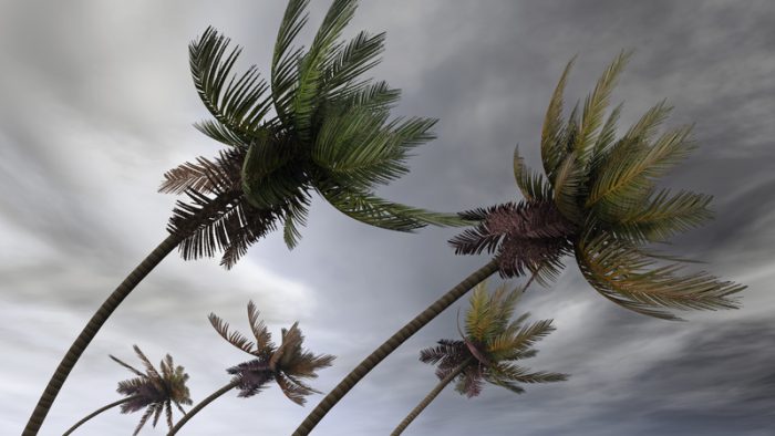 Residents across the Hawaiian islands are bracing for the worst and hoping for the best. (© Mike_kiev | Dreamstime.com)






I feel so bad for the U.S.A! In the past year, they’ve had 3 hurricanes! 😯