Welcome back to our Science Odyssey Contest event, where we're posting STEM articles from May 2 to May 17. To enter, you can find details at the bottom of this post.
A recent study from researchers at Penn State University is calling for a new term in global weather reporting.
They call it 'gargantuan hail', and though the term itself might seem pretty obvious, understanding why it happens is anything but.
Hail, hail
A Colorado man shows off egg-sized hail collected during a 2018 hailstorm that damaged cars, roofs, and solar panels. (Getty Embed)
Hail is a type of precipitation that falls not as rain or snowflakes, but as ice, called hailstones. Generally, hailstones are anywhere between 5 mm (0.2 in) and 15 cm (6 in) across.
Gargantuan hailstones are over 15 cm (6 in) wide.
All hailstorms are considered dangerous to property, animals, and people. This is why meteorologists (scientists who study weather) do their best to warn us about approaching hailstorms. In the cases of gargantuan hail though, that advance notice is even more important.
Storm on the horizon
The new Penn State study refers to a storm in 2018 in Argentina, which produced what may be a record-setting hailstones. The stone at the top of this post was recovered by teenager Victoria Druetta, who raced outside in her brother's motorcycle helmet to capture her frozen souvenir.
Meanwhile, a video from the same storm below showed several mega-stones of gargantuan hail hitting the pavement. The one that drops at 0:11 wasn't recovered but is estimated to have been up to 23.6 cm (9.3 inches) across! That's enormous!
Granizo en Villa Carlos Paz @todonoticias pic.twitter.com/RJakJjW8sl
— Leonardo Orozco (@LeoOrozco3105) February 8, 2018
Watching that video, you can understand why the scientists want a term like gargantuan hail—one that tells the public that this storm will be different. The one problem?
Researchers so far haven't been able to pinpoint what makes a storm one that will produce such huge hail.
Trying to predict gargantuan hail
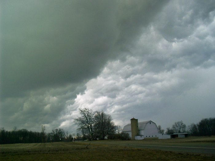
Severe thunderstorms with strong upward winds called updrafts produce hail. (Wikimedia Commons)
What we do know is that all hail is caused by thunderstorms in certain warm, humid conditions. Super strong updrafts (an upward-moving wind) carry water droplets inside the base of dense clouds higher up into the atmosphere where the air is much cooler — below freezing, in fact.
Swirling around in this chilly updraft, the water droplets freeze and collide, sticking together into frozen balls. Hailstones.
In theory, the stronger the updrafts, the more potential for hailstones to stay suspended and get larger in this freezing air before gravity pulls them down to Earth. But according to their study, researchers found a "lack of indications of an extreme event" in the conditions and forecasts before the storm.
Warmer weather = what?
Getting caught in an unexpected hailstorm is no fun. (Getty Embed)
Where this gets tricky is that many climate models are predicting that climate change will bring us more extreme weather. And in terms of super storms like hurricanes, this might be coming true. But scientists are unsure of whether warmer weather will mean instances of stuff like gargantuan hail.
On one hand, as thunderstorms get more intense, and full of stronger updrafts, we might get more hail. But warmer weather might decrease hail, too. The tropics get less hail because even their high air doesn't get cold enough to freeze the water.
Scientists agree that more studies need to be done so that we can fully understand this frozen hazard. Wow!
Contest alert
Don't miss our Science Odyssey Contest. Click HERE TO ENTER.

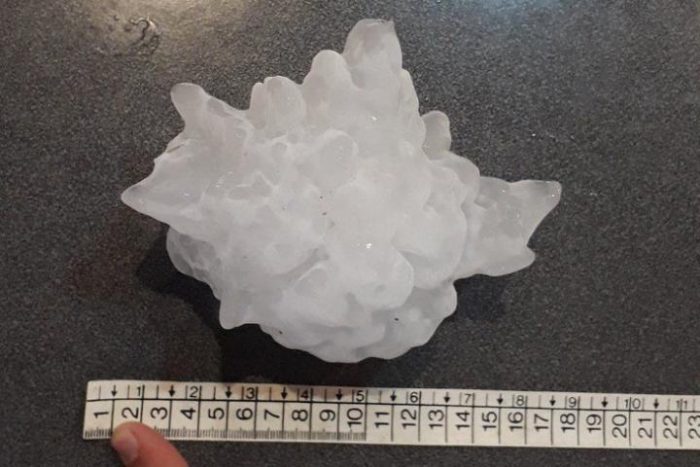 An 18-centimetre (7-inch) wide piece of gargantuan hail recovered from a 2018 storm in Argentina. (Victoria Druetta)

