It’s been over 10 years since the Curiosity rover touched down on the surface of the red planet. Since then, the enterprising robot has been roaming far and wide across the Martian landscape. Its mission? To collect rock and soil samples to determine whether Mars ever was habitable to microbial life, or if it could support any life even now.
Curiosity has recently traveled to the side of Mount Sharp, a large martian mountain next to the Gale Crater where it has spent most of its time exploring. As with any important mission, it’s necessary to take time to capture photos and soak in the beautiful scenery!
Views from Mars
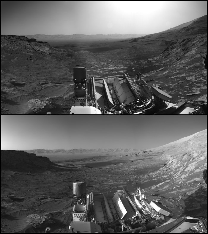
Original images taken by Curiosity. The top picture is Mars in the morning, and the bottom in the afternoon. So similar—yet so different—from Earth! (NASA)
While atop the mountainside, the rover has captured some impressive images of the natural Martian landscape. Back on Earth, the NASA team assembled the photos to create one large panorama image for our viewing pleasure (see image at the top of this post).
To create this stunning image, the team combined two versions of black-and-white pictures from different times of the day. Then, using a bit of photoshop magic they added blue and orange to simulate a panoramic time-lapse. Even though the picture itself has been edited, this is the most accurate depiction of what we would see if we climbed to the top of Mount Sharpe to witness a sunrise. (For a high-definition version of the picture, click here.)
In the centre of the image is the view descending down Mount Sharp, overlooking the Gale Crater. There is still a long way up the mountain to go, Curiosity has so far only climbed a little!
The view also captures a field of rippled sands called the Sands of Forvie, as well as rounded hills to the right of the centre where the rover explored last year.
Remarkably, Curiosity’s mission was only planned for two years, is still going strong today! The rover’s observations have done awesome work on improving our understanding of our neighbouring planet.
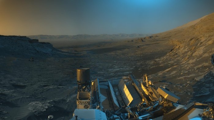 Curiosity’s selfie overlooking the Gale Crater and beyond. (NASA)

