Before 1980, Mount St. Helens was mostly known as a large, beautiful volcanic mountain in the Cascade range. Though there were records of minor eruptions back in the mid-1800s, it was largely seen as being dormant (meaning it was inactive or "sleeping"). People explored in the forests surrounding it, and camps and summer activities were run at Spirit Lake, which was just nearby. Climbers even hiked up the mountain.
But in March of 1980, geologists noticed that something new was happening inside the mountain. Minor earthquakes began occurring, followed by small phreatic (say: FREE-tick) eruptions (those are eruptions of steam caused by underground water heating up super fast). Then there were explosions of ash that flew over 3,000 metres (10,000 feet) into the air. Scientists could tell that the magma, or molten rock, inside Mount St. Helens was moving. The volcano wasn't dormant anymore.
Sending out the warning
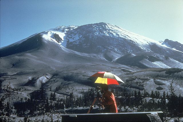
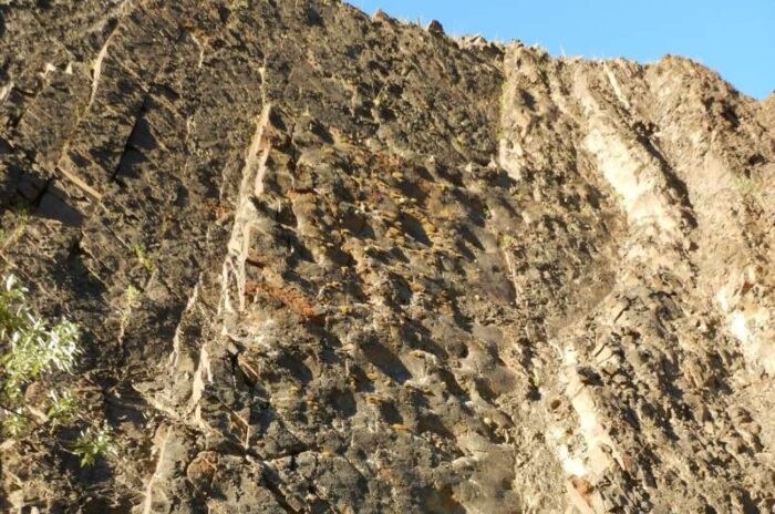
The cryptodome as it looked on April 27, 1980. (Wikimedia Commons)
That's when the USGS (United States Geological Survey) began warning people that Mount St. Helens was unsafe. In early April, a bulge at the top of the mountain, called a cryptodome, began to grow. This was from pressure of more and more magma building up inside. Imagine a force so strong that it makes rock expand like bubblegum! All through April and early May, the bulge grew by over 1 metre (5 or 6 feet) a day.
Scientists believed that the bulge was like a cap on a shaken bottle of pop. Eventually the pressure would cause the bulge to come off. This would cause a massive landslide. And after that, there was a very good chance of a powerful eruption.
The volcano erupts
On the morning of May 18th, at 8:32am, that is exactly what happened. First an earthquake at the mountain's base triggered the landslide, which is still the largest one in recorded history. It traveled 21 kilometres (13 miles) and covered an amazing 62 square kilometres (24 square miles). In some places, the dirt and rocks from this slide were 180 metres (600 feet) deep. That's as tall as a 40 floor skyscraper!
Then came the eruption itself. It happened in stages, including a lateral (or sideways) blast of super hot gas and ash, a massive flow of lava, a mudslide, and a huge column of ash that shot high into the sky and expanded to be many kilometres wide. In fact, the ash column reached an unbelievable 24,000 metres (80,000 feet) into the atmosphere. (Commercial airplanes fly at only about 10,000 metres or 33,000 feet high.)
Like another planet
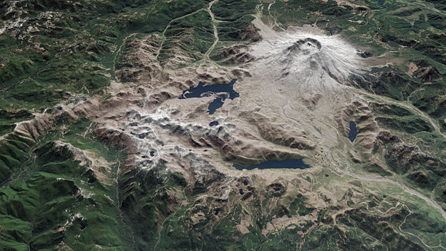
A NASA picture of Mount Helens and the area around it in 2015. You can see how one side of the mountain was completely blown off, as well as the huge area that was covered by rock, ash, lava, and mud. (NASA/Wikimedia Commons)
In the end, the eruption turned acres of bright, healthy green forest into something that looked like the surface of the moon. Even today, 36 years later, much of the land surrounding the volcano is barren and free of vegetation. Nearby Spirit Lake is still full of the trunks of fallen trees blown into the lake by the force of the eruption! But despite such devastation, very few people died on that day. This is because the USGS and its scientists were so determined to ensure that people were not allowed to be close to the volcano in spring of 1980. They knew that an active volcano is nothing to mess with!
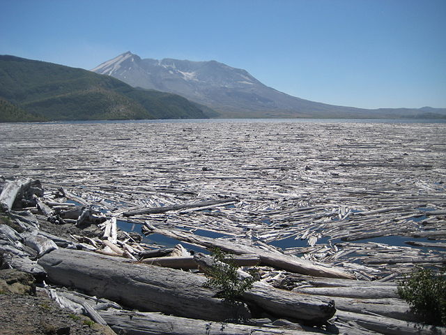
Fallen trees, or tree mats, are still all over the surface of Spirit Lake. This photo was taken in 2012. (Wikimedia Commons)